1839 Map of Ayrshire, Scotland
A rare 1839 engraved map of Ayrshire, with the Parish borders hand tinted at the time. The whole sheet measures 12 by 9.5 inches. Drawn and engraved by W.H. Lizars, Edinburgh.
This map came from a large broken atlas which was originally in Gordon Castle, Banffshire. An important aspect of this map is that all the Parishes are shown, and the map is also of great interest due to the numerous small locations named. These include interesting places such as the Glenbuck Iron Works, Burn's cottage and monument, and Kaimeshill iron Works. Places and parishes shown include: Ardrossan, Auchinleck, Ayr Burgh and Parish, Ballantrae, Barr, Beith, Colmonell, Coylton, Craigie, Cumbraes, Daily, Dalmellington, Dalry, Dalrymple, Dreghorn, Dundonald (including Troon), Dunlop, Fenwick, Galston, Girvan, Irvine, Kilbirnie, Kilbride, Kilmarnock, Kilmaurs, Kilwinning, Kirkmichael, Kirkoswald, Largs, Loudoun (including Darvel and Newmilns and Greenholm), Mauchline, Maybole, Monkton, Muirkirk, New Cumnock, Ochiltree, Old Cumnock, Prestwick, Riccarton, St Quivox, Sorn, Stair, Stevenston (including Saltcoats), Stewarton, Straiton, Symington, Tarbolton. Referenced in The Early Maps of Scotland, by the Royal Scottish Geographical Society, 1973.
From the collection of Kate Maynard
|
Click on thumb for larger image 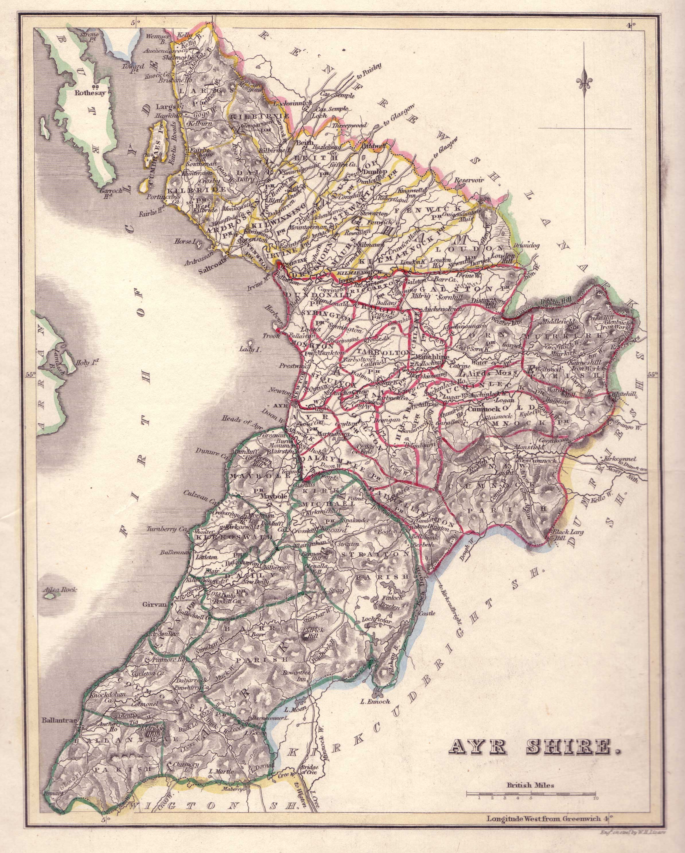 |
Detail of the northern area of Ayrshire: 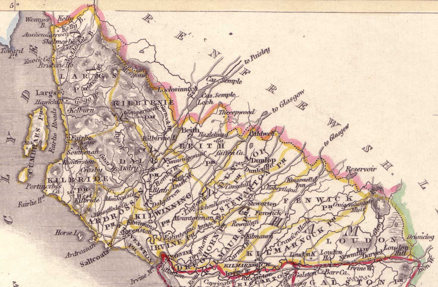 |